
Historical Disaster Datasets
Discover comprehensive historical disaster datasets, meticulously consolidated and standardized from authoritative sources. Our data services bring together national and sub-national data into a single, cohesive schema, ensuring ease of use and interoperability.
Whether you're a researcher, planner, or decision-maker, our datasets provide the spatial insights you need to analyze past events and prepare for future challenges. Let us help you navigate the complexities of disaster data with our expert services and innovative solutions.
Historical Forest & Brush Fires
Detailed records of past wildfire occurrences, including precise ignition points and burn area boundaries, available in point and line formats.
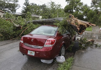
Historical Tornado & Wind Events
Our historical tornado dataset offers detailed records of tornado occurrences, including their paths, intensities, and impacts, essential for analysis and preparedness.


Historical Landslides
Our architecture services prioritize function and form to create spaces that stand the test of time. Detail the locations, triggers, and impacts of landslides
Historical Droughts
Monitor the extent, duration, and effects on agriculture and water supply
Severe Storms
Our architecture services take into consideration your lifestyle and preferences to create spaces that are both beautiful and functional.


Tsunamis
Document wave heights, affected coastlines, and resulting damage..